

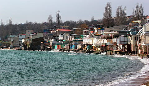
On 24 September UN General Assembly adopted first ever declaration on rising sea levels which pose existential threat. Rate doubled from 2.1 mm a year 1993-2002 to 4.7 mm a year 2015-2024 per WMO. In 2024 alone sea rose 6 mm, largest annual increase.
Experts Explain by Shivang Agarwal & Nimish Singh: Declaration focuses on loss of territory faced by vulnerable countries Tuvalu, Kiribati, Maldives. Also asks nations to build sea-level rise projections into planning and design of coastal infrastructure - area of note for India.
Read more - THE SINKING METROPOLIS
What does India gain? Sibi George, Secretary West MEA, welcomed declaration and backed stable maritime zones and continuity of statehood. He reaffirmed equity and common but differentiated responsibilities.
Can country retain statehood if loses territory? Under 1933 Montevideo Convention, State defined using four criteria: permanent population, defined territory, government, capacity to enter relations. If sea swallows defined territory, does it still remain State? UN declaration attempts to settle: affirms country stays country when sea takes land.
Key provision: Countries can maintain nautical boundaries calculated from coast even when it retreats. So pledge to keep those nautical boundaries fixed protects India's waters. Lakshadweep and Andaman and Nicobar Islands carry India's boundaries far into Arabian Sea and Bay of Bengal.
Read more - Dolphin's Warning
National Centre for Coastal Research tracked mainland shoreline 1990-2016 found about a third eroding. 45 million Indians may be at risk by 2050, especially Sundarbans, Kendrapara, Nagapattinam.
Tags: #SeaLevelRise #CoastalErosion #UNDeclaration #ClimateChange #IndiaCoastline #Tuvalu #MaritimeBoundaries #Sundarbans #CRZ #GlobalWarming